MAPA OCEANO PACÍFICO
23 Outubro, 2006 at 8:46 am Deixe um comentário
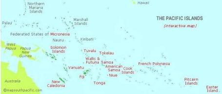
(via http://www.mapsouthpacific.com/pacific/index.html)
“The Pacific, greatest of oceans, has an area exceeding that of all dry land on the planet. One theory claims that the moon may have been flung from the Pacific while the world was still young.”
David Stanley, Moon Handbooks South Pacific
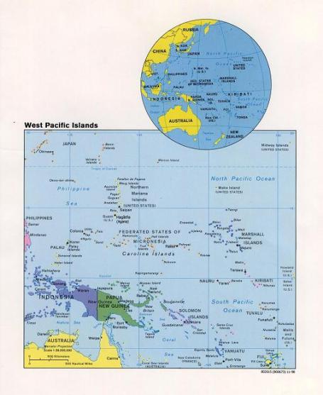
(via http://www.lib.utexas.edu/maps/australia/west_pacific_islands98.jpg)
Uma primeira aproximação, muito geral: Tonga, Tuvalu, Vanuatu e Kiribati (entre outros “micro-estados”) situam-se – todos – algures, no imenso Pacífico Sul, entre a Austrália e a América do Sul.
É nesta região que se situa também a parcela de terra mais isolada do resto da humanidade: a Ilha da Páscoa (Easter Is.), “um ponto perdido” no Oceano Pacífico, a meio caminho entre a costa da América do Sul e o Tahiti, distando 3 700 km do Chile (país a que pertence) e 4 050 km de Papeete (Tahiti).
Entry filed under: Da Vinci.


Subscribe to the comments via RSS Feed